Arrowhead 135 Central (#AH135 2013)

Ali will be competing in the Arrowhead 135 race this coming Monday, January 28th.  Here she is on the right:

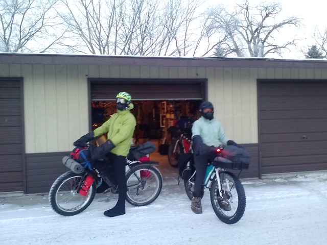
On the left is Ted.  They’re planning on riding together for the race, since it’s the first one for them both.  Ali’s feet are artfully camoflaged so that she may pedal undetected (in fact these are boot covers, and they are Dave Simmons approved).

For family and friends, here is some information about the race this year:

  • Official website: http://www.arrowheadultra.com/
  • Official results: http://www.arrowheadultra.com/index.php/results/2013-results  NOTE: The official results are not going to be super up-to-date, because they get uploaded when the race organizers get a chance.  So if you see it’s been a long time since Ali and Ted have come through a checkpoint, don’t worry.
  • LIVE MAP: http://mattbk.com/~matthewbk/warrior.html (new window).  Ali is carrying a SPOT tracking device that she will be “checking in” with during the race.  As she checks in, her position will show up on the map, and each check-in will be listed on the right side.  Although the SPOT device communicates with satellites and not with the cellular network (which is spotty in the area), there may be a delay in posting the most current position.  (Computers are involved, so who knows what will happen.)
  • Other racers: http://trackleaders.com/arrowhead  You’ll also be able to live track some of the other racers at this map, if you’re interested in what else is going on.
  • Update: news video from the week before: http://www.wday.com/event/article/id/74326/
  • Regarding all safety and emergency protocols: volunteers on snowmobiles will be going back and forth on the course throughout the race.  I will also be at the race and meeting up with Ali and Ted at various road crossings.  If you are relying on the map or results linked to here and are worried, please DO NOT try to contact the race directors–call/text me instead, I will know what is going on.
  • I will be updating Facebook as much as I can with relevant information (and hopefully photos), but this will depend on the cellular coverage.
  • For general race info and positions and photos, you can follow me on Twitter at nplainsathletes or you can follow along with the hashtag #AH135 (I have no idea how much this will get used, but I know at least a few others should be using it).

Ali will be competing against 10 other women this year, under conditions that are actually expected to be warmer than normal!  We’re both super psyched to see how she does, see a new area of Minnesota, and be part of a great endurance tradition.

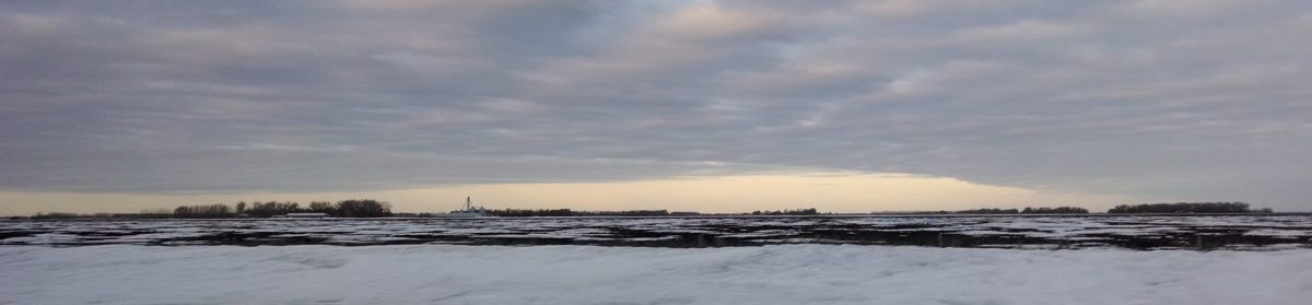
A nice Sunday morning drive:


One final note: you can leave comments here, but I will probably not be able to reply to them until we get back from the race.

Creating a live-tracking SPOT map with IFTTT and Google Drive

My wife is doing an endurance cycling event in the near future, and so I was inspired to create a public live-tracking map to relay her progress to others.  It wasn’t too hard to set up; if you have a SPOT tracker, follow the instructions below.  These instructions can be modified to take an SMS text as well, as long as the formatting remains constant.

0.  Make sure your SPOT device is sending emails to the gmail address you have set up for IFTTT.

1.  Set up an IFTTT action like this:

– Trigger: new email from ________ (in my case, the source of the SPOT email)

– Action: add row to spreadsheet.

– Formatted row: {{ReceivedAt}} ||| {{BodyPlain}} ||| =(split((TO_TEXT(INDIRECT( ADDRESS( ROW( ) ; COLUMN( ) -1)))),” :”))

This format takes the received time and the body and then splits the body according on two characters, ‘ ‘ (space) and ‘:’ (colon).  This is due to the way the email is formatted.  The neat “take the column before this one” function I borrowed from another IFTTT action.

2.  Run the action once and open up your new Google Drive spreadsheet.

– Add a header row and fill it in.  Call the first column “title” and then find which columns contain the latitude and longitude and label them respectively.  You will have a bunch of columns because of the length of the email body.  I would tell you which column numbers to name, but it depends on the number of words in your SPOT device name.

– Fill in the rest of the header row with something for each column that has a value in it (this is so Google Maps can process the spreadsheet).  I chose to call all the non-vital columns “ignore”.  As long as you leave the header row, you can clear this spreadsheet as often as you like, and IFTTT will just add new data to the first empty row.

3.  Head to the Spreadsheets Map Wizard at http://gmaps-samples.googlecode.com/svn/trunk/spreadsheetsmapwizard/makecustommap.htm and follow the instructions.  This is where you actually build the map.  (I am not responsible for that site.)

4.  Copy the output from the Spreadsheets Map Wizard into a new .html file and upload it to a server somewhere.  I suppose you could theoretically even share it online via Dropbox.

5.  Success (I hope)!

Obviously, there are a lot of places this workflow can go wrong, so take your time and double-check each step before moving on.  Note that the spreadsheet wizard may stop working soon because Google is dropping v2 of the Google Maps API sometime “in early 2013.”  I can’t guarantee I’ll be able to update my map to v3 of the API because I’m not the greatest with javascript.  

My finished product (with some extra KML layers) is here: http://mattbk.com/~matthewbk/warrior.html


ArcGIS Tricks

Since I now use ArcGIS for my job (instead of QGIS, which I used for everything else, except for Drupal, where I use OpenLayers), I have to re-learn everything I once knew.  Part of this involves the nitpicky issues that span both ESRI’s programming choices and their documentation.  I will continue to update this post as I learn more.

ArcGIS 10.1:

  • When using the Contour tool, there cannot be any spaces in the output path.  Not just the filename, but the whole path to that file.  The full list of characters you can’t use (just to be safe) is here (even though the output is a vector).
    • Errors you may get: 010328 : Syntax error, 010267 : Syntax error in parsing grid expression.
  • When exporting a shapefile that has a joined table (i.e., to create a new shapefile so you can query the joined data), the filename of the table that is being joined needs to be pretty short.  Otherwise, the shapefile is not exported completely and there are no errors–Arc actually “finishes” and lets you add the new shapefile.  Taking spaces out of the filename probably can’t hurt either.

Saying No

I recently got back comments on a version of my dissertation draft, so I will again have little time to do much.  Things I’ve said ‘no’ to recently: setting up a general Grand Forks online forum and hosting a local nordic ski race (because we don’t have any in town).  If anyone is interested in doing either of these things, go ahead, because I can’t invest the time in them right now.

Got #Results?

I’ve dabbled in hosting results before, but it became a big mess very quickly, so I set it aside.  I’d still like to incorporate a regional athlete ranking system someday, akin to that on crossresults.com, but that won’t happen until there’s a little more user interaction.

Results are important, however, so I’d love to at least link to them on the site.  There being a lot of races, this becomes difficult unless you (the race director!) send them in.  Skinnyski has a great writeup on results and Google Docs/Drive and how to get things in the right format.  Ship your results to me in any format (even including snapshots of the results sheets) and I’ll get them up under the right event.

Results will be accepted in the following manner:
– in an email to matt@northernplainsathletics.com
– in a comment on the event page (this will get them out there the most quickly)
– in a tweet to @nplainsathletes, with the hashtag #results
– in a post on the Northern Plains Athletics Facebook page

Thanks for the help!
– Matt

Baby, You Can Drive My Bus

On the list of things not to worry about in Grand Forks (unless Google buys the city as an experiment) is the idea of driverless vehicles.  I think one comment really nailed it:

The allure of a driverless car is that you can travel nearly door to door without having the burden of operating the vehicle or needing to pay attention to the road. However, that reality already exists. Its called a bus. When its below ground its called a train. An added bonus, you don’t even need to find parking for it. Why is this news to people? Mass Transit is here and its real. And if we seriously commit to it, we can make it way more useful than any driverless vehicle ever will be. (dave “paco” abraham