A few maps to share.
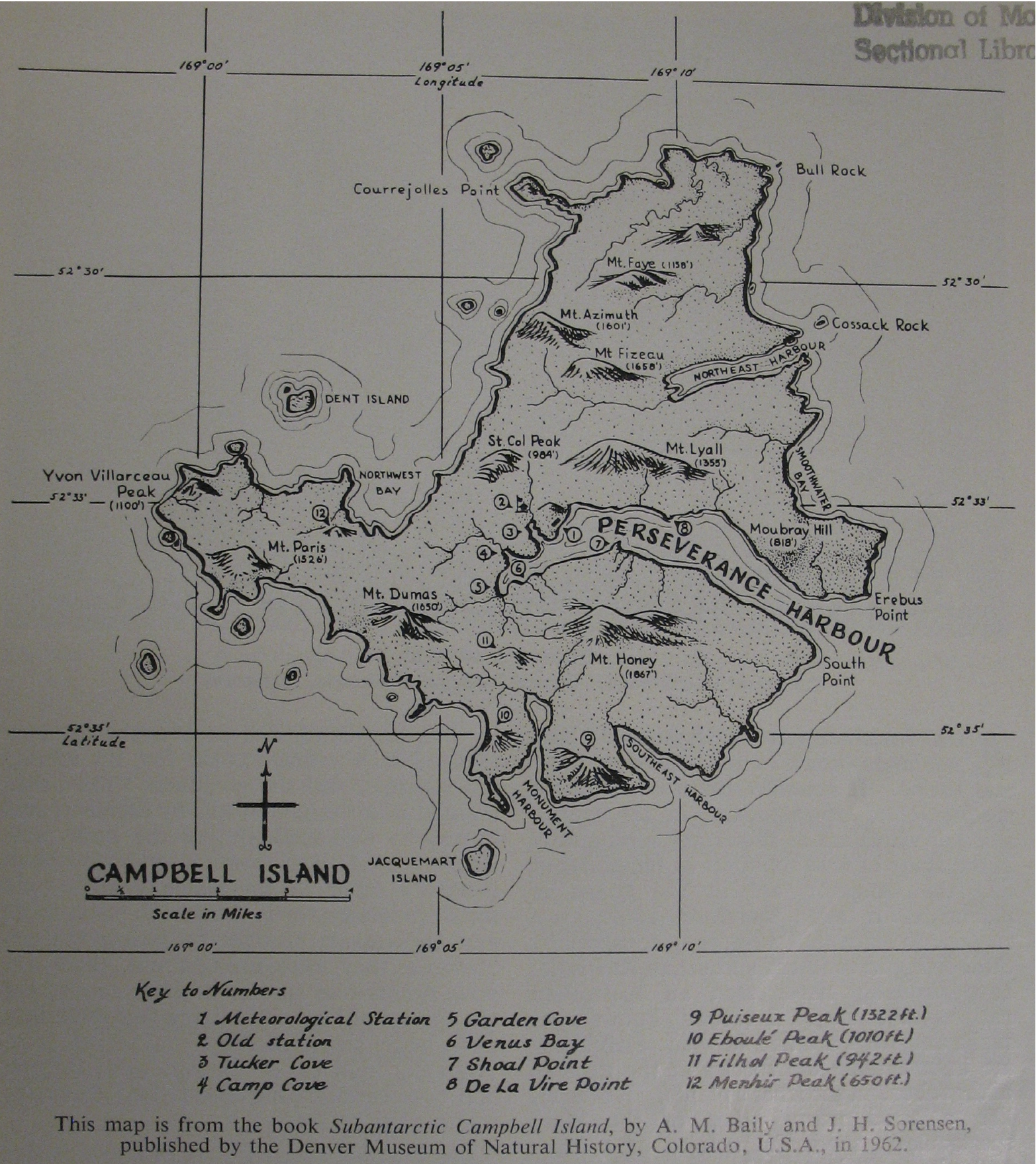
Campbell Island map, by Bailey and Sorensen (1962) as printed in Smith (1969).
Matt Burton-Kelly's home on the Web
A few maps to share.
Campbell Island map, by Bailey and Sorensen (1962) as printed in Smith (1969).
Need to write a post on this idea once Joe Vacek gets back at the end of the summer. The idea is that, in order to prevent unnecessary driving on campus, you are assigned a lot when you buy a parking pass and are only allowed to park in that lot.
Resources:
Joe Vacek
Council On Environmental Stewardship and Sustainability
CESS minutes 18 May 2010 (PDF)
UND Climate Action Plan (2010, PDF)
GGF MPO (why?)
As Tuition Prices Rise, Fresno State Spends $4 Million on Parking
This editorial in the Dakota Student is from back in April, but it suggests one more way in which UND and Grand Forks can agree on something in the future–if both entities agree to create a unified complete streets transportation policy.
The thought arises at a moment such as this as to the importance of sidewalk maintenance and safety. Obviously the road is worthy of cars and loading trucks, but when was the last time the cobblestones were inspected or fixed? This area might not be used for car travel, but students consistently navigate these regions.
Not something you would typically expect from a student newspaper, is it?
 |
| ND: at the bottom of the 2012 League of American Bicyclists state rankings. |
The League of American Bicyclists have come out with their 2012 state rankings, and North Dakota managed to beat out Arkansas for the 49th most-bicycle-friendly state. As one commenter in on the Facebook group BIKE FARGO 365 put it, “not surprising!” The state scorecard can be found here or linked at the bottom of the state ranking page..
Why exactly is this not surprising? The League is pretty clear where we’re lacking, and pretty clear on what we need to do to improve. North Dakota has failed to achieve any of the “Top 10 Signs of Success” regarding cycling and clearly needs a statewide Complete Streets policy. But let’s step back a bit: sure, North Dakota as a whole isn’t going to compete with our neighbor Minnesota (#2, home to Minneapolis, just picked for best bikeability by WalkScore) or with Oregon (#1, home to Portland, this year’s best bike-friendly city according to Bicycling Magazine), but I don’t think we need to try for that right now. What we can focus on is doing something local, and doing something now.
Each of the “Top 10 Signs of Success” can be achieved here in Grand Forks just as easily (or even more easily) than they can at the state level. The same goes for Fargo, and for Bismarck and Minot. I’m not trying to discount the other cyclists in the state, but lobbying for “bike friendliness” (as part of a greater Complete Streets initiative) might have a greater effect in the places where cycling is most viable as a transportation option: cities and large towns. Grand Forks can be more nimble than the state in enacting policies that support all forms of transportation, and what we succeed at can be used as a model for the rest of the state.
Which of the “Top 10 Signs of Success” do you think are the most achievable in Grand Forks?
 |
| “Top 10 Signs of Success” from North Dakota’s 2012 League of American Bicyclists scorecard. |
UPDATE: This attempt has been abandoned at the advice of one of the SME developers. R was suggested as an alternative.
Sometime this week I hope to get the Spatial Modeling Environment up and running on at least one of my computers (office Windows 7 PC, Macbook Pro OS X Snow Leopard, or Ubuntu 12.04(?) in VirtualBox), but I’m posting this as a shoutout to anyone who has attempted this before: the README is pretty technical, and I could use some help.
This is also a note to developers (even if they are scientists) who write “user-friendly,” “icon-based” software and then make you jump through command line hoops to install it. Stop it. What are you trying to accomplish? The more people who can install your software, the more people will use it, and the better it will become.
I don’t think I’m being unnecessarily harsh. Luckily, I really want to use this software and I’m fairly comfortable following detailed specifications and dealing with the command line, but there are others who aren’t. Hopefully I can follow the directions and install this software and use it for my dissertation; hopefully I can put together some sort of installation tutorial that is clearer than the README; and hopefully this will help someone in the future.
P.S. I’m working through Landscape Simulation Modeling this week as well, and I’m pretty pumped to try SME. How’s that for an endorsement?
 |
| Screenshot from the Grand Forks Streets Crowdmap. |
As can be seen in some of the earlier posts, it was an original intention of this blog to report on the “state of the streets” in Grand Forks and East Grand Forks. In order to get more people involved in this process, we’ve set up a crowdmap:
Anyone can use this map to report both the positive and negative features of our transportation system. You do not need an account, and you can even submit reports from your Android phone, iOS device, or Twitter (Twitter functionality has not been completely tested).
Reports are moderated for now; depending on how many people contribute moderation may be turned off in the future. One important note is that when you are submitting a location from the website, you should either 1) first click “Clear Map” before marking a point; this removes a point that is automatically added to the map or 2) drag the point on the map to the location you wish to mark.
Please check it out, play around, and let us know what you think!
take some photos while out and about of good streets things happening in town
– bike corral in front of Dakota Harvest
– bike racks in downtown
– bike lane on University through UND
– town square and other small downtown parks (=urban shared space)
Heather Jackson’s articles about cycling experiences in the Herald and the DS.
This just in from schaefs:

The meeting announcement (with more detailed information) can be found here.
The Grand Forks Herald has this article today on the push for a south-end truck bypass, including a Merrifield Road/I-29 interchange. What do you think of such a plan?
 |
| From the Grand Forks Herald, 16 May 2012. |