After a little bit of troubleshooting yesterday with some input files, I’ve updated my kamelseesv script to add a few more lines about the output format (latitude and longitude will appear reversed in the KML file, but they are really in X,Y format instead of Y,X format) and to allow you to view/download the result rather than copying and pasting into a text file. This should let people preview converted datasets without having to save each and every one of them.
[activity] Too Flat, Too Furious 2011 (April 30th, May 1st)
The weekend was a half-success (only because we woke up to snow and ice on Sunday and had to cancel the road race).
As Race/Event Coordinator for the UND Cycling Club:
– Organized the UND race weekend on April 30th and May 1st, including a great number of things listed here.
– Kept the criterium course mostly free of cars (need more volunteers to be able to do this at the Ralph Engelstad Arena next year.
– Got some folks from out of town to show up and race the open USAC categories.
– No serious injuries even though there were several crashes.
As member of the UND Cycling Team:
– Placed 1st in the men’s category C race after a crash behind me in the last lap (that’s racing).
– Fourth rider on the 2nd-place men’s UND team in the 2011 North Central Collegiate Cycling Conference Team Time Trial Championships.
[portfolio] END-SPAR 2011 poster

The background to the 2011 END-SPAR (Extreme North Dakota Spring Primer Adventure Race) poster was an idea Andy Magness had that he hired me to put together. I couldn’t find a good shoe image so I took a photo of my own Inov-8 show to throw on there.
Flower image: 1st Crocus by KitAy on Flickr.
ENDracing logo: ENDracing.com
All text is by Andy.
[activity] Employee of the Month at Northern Heights Rock Gym
The “management” (and I use this term loosely because I don’t think they want to be called “management”) at Northern Heights Rock Gym started an Employee of the Month program this year, and I’m the winner for April, which means I get my own special parking spot* and some cash. For a volunteer-only business, this is as much as they can do for us, but I think it’s a great incentive.
*I do not get a special parking spot.
[activity] 2011 UND Scholarly Forum
Presented a poster during the 2011 UND Scholarly Forum, hosted by the Graduate School at UND.
BURTON-KELLY, M.E., J.H. HARTMAN, and A.E. BOGAN. 2011. Determining temporal and geographic limits of fossil freshwater mussels of the family Hyriidae. The Graduate School Scholarly Forum, March 8 – 9, 2011, University of North Dakota, Grand Forks, North Dakota, USA, p. 73. Abstract and poster PDF 9.5MB
There were only three of us from Geology and Geological Engineering, so next year we’ll have to represent better.
Snapshot: Crossing at DeMers Ave/S. Columbia Rd Interchange
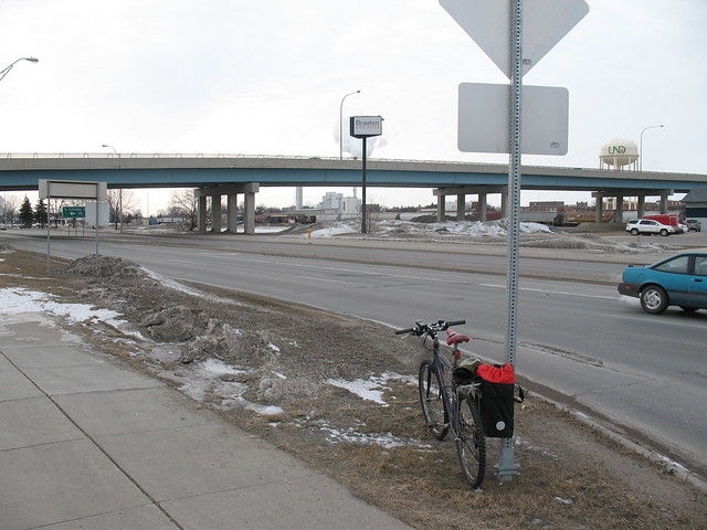
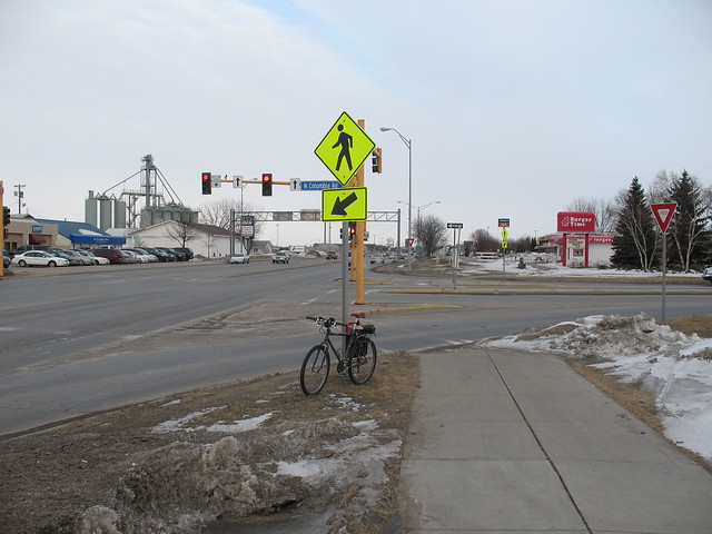
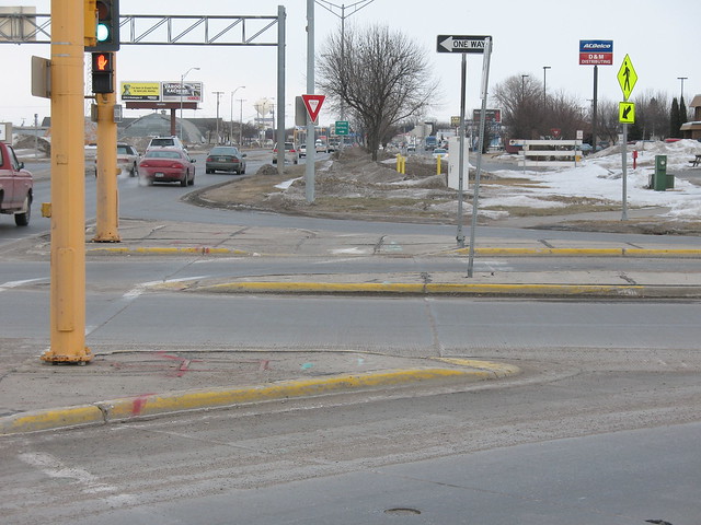
Trying to keep the words to a minimum, but here is an intersection in Grand Forks that I find particularly worrisome, especially for people to whom cycling/commuting is new. This crossing is the primary avenue between the University of North Dakota (to the north) and points to the southeast. The protected sidewalk on the S. Columbia Rd. overpass is used by riders because the traffic on the often exceeds 35 mph and people are not used to cyclists. See map at bottom of post.
Most problematic: drivers merging onto the northbound onramp and off the southbound offramp. They do not expect to stop because all they have is a yield sign. Drivers merging on are especially dangerous because they have little need to yield most of the time, and see little reason in signaling.
Suggested solution: Unsure. Would be nice to straighten out the crossing (will have to take a photo now that it’s snowed again) to make it easier for people on the path, but something needs to be done to prevent merging drivers from running into riders and drivers stopped at the red light from stopping in front of the pedestrian cutout ramps (on the crosswalk).

Total time on this post: 46 minutes.
Need a geologic time scale? Use TimeScale Creator!
I didn’t know this existed until today, so I’ll give it a little promotion. I was in the midst of building my own in Illustrator by tracing the official 2009 timescale from stratigraphy.org (the PDF has font issues on my computer, apparently).
TimeScale Creator
Overview
We’ll see how it works for my 2011 UND Scholarly Forum poster. Wish me luck.
EDIT: Had some problems saving the image as a PDF in Mac OS 10.6.6 (Snow Leopard), but saving as SVG works fine. If a save seems to fail, you need to restart the program and try again. Using version 4.2.5.
Working definition of ‘sidewalk’ versus ‘path’
I need to determine width, material, and crossing restrictions. This will be applicable first to Grand Forks, then maybe with feedback to other places in the future.
Useful for:
– Asking for appropriate facilities from city government
– Clarity of communication
– OpenStreetMap (may be best to get a list of the possible names for these terms, or ask in their wiki as well)
[portfolio] Bikecicle 2011 flyer
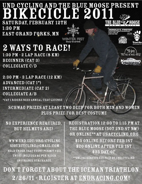 Not only did I muddle my way through organizing Bikecicle this year, I again chose myself to design the race flyer. This year’s model is Max, shown riding a fixed-gear with studded tires on a skating pond in University Park here in Grand Forks.
Does your apartment building have indoor bike storage?
An exploration on how many people live in buildings with such amenities, and where they might be found in this town. Not that I’ll get any responses.
http://www.saris.com/commercial-parking/creating-your-space-/indoor-parking-planning.html